In a breakthrough that could revolutionize indoor navigation and mapping for drones, researchers have developed a real-time framework that allows Unmanned Aerial Vehicle (UAV) swarms to operate effectively in GPS-denied environments. This innovation, published in the journal Scientific Reports, is the work of Gabryel Silva Ramos and his team at the Control and Automation Laboratory (LACEA) at the Federal Center for Technological Education Celso Suckow da Fonseca (CEFET-RJ) in Brazil.
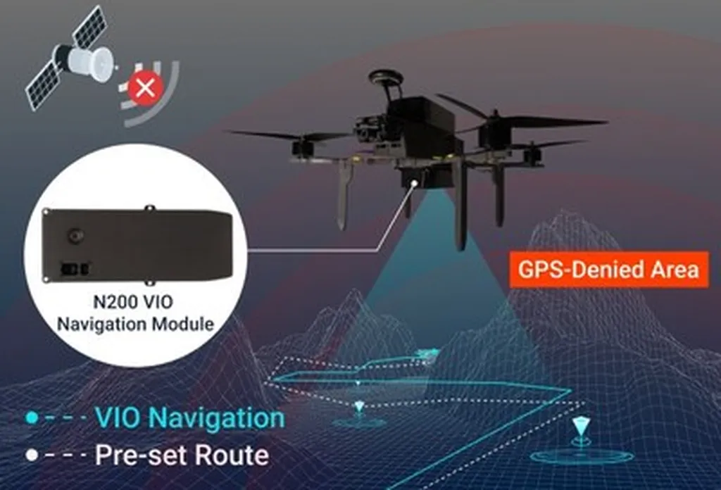
The system, built on the Aerial Robot Cognitive Network Architecture (ARCog-NET), employs a multi-layered Edge-Fog-Cloud (EFC) hierarchy. This setup supports decentralized decision-making and adaptive coordination, including dynamic path optimization. Essentially, each drone in the swarm estimates its own trajectory while contributing to a shared 3D map of the environment by exchanging visual landmarks with other drones.
One of the most intriguing aspects of this research is the use of reinforcement learning. The system dynamically adapts navigation paths in response to operational events, guided by trajectory coverage metrics and historical decision weights. This means the drones learn and improve their performance over time, making them more efficient and reliable.
The practical implications for the maritime sector are significant. Imagine a swarm of drones navigating the complex interiors of large cargo ships or offshore platforms, conducting inspections, and creating detailed 3D maps without the need for GPS. This could greatly enhance safety and efficiency in maritime operations, reducing the need for human inspectors to enter potentially hazardous environments.
Gabryel Silva Ramos explains, “Through a novel formulation, each UAV jointly estimates its own trajectory and contributes to a shared 3D reconstruction of the environment by exchanging matched visual landmarks across the network.” This collaborative approach not only improves the accuracy of the maps but also ensures that the drones can navigate autonomously and adapt to changes in their environment.
The system was tested with six DJI Ryze Tello UAVs in a controlled indoor lab environment, demonstrating autonomous swarm navigation and collaborative 3D mapping. The performance was evaluated through metrics such as trajectory error, point cloud fidelity, decision convergence, and knowledge reuse rate. The results were promising, confirming that the proposed method enables scalable, autonomous SLAM (Simultaneous Localization and Mapping) and planning capabilities in real-world UAV networks.
For maritime professionals, this technology could open up new opportunities for autonomous inspections, maintenance, and mapping. The ability to deploy a swarm of drones that can navigate and map complex environments without GPS could be a game-changer, particularly in scenarios where human access is limited or dangerous.
As the technology continues to evolve, we can expect to see more applications in the maritime sector. The cognitive synergy between navigation and perception in distributed aerial robotics, as highlighted by Ramos and his team, is a testament to the potential of this innovative approach. With further development and testing, this technology could become a standard tool in the maritime industry, enhancing safety, efficiency, and operational capabilities.